Glacier outlets from Jostedalsbreen
Norwegian Glacier Museum has gathered information about some glacier outlets from Jostedalsbreen.
Here you can learn about Bøyabreen and Supphellebreen in Fjærland, and Nigardsbreen in Jostedalen, which is one of Norway's best known and most studied glacier arms. In total, there are 37 named glacier arms flowing out from Jostedalsbreen.
"On the map, Jostedalsbreen looks like a fantasy animal clinging to the mountains with many arms down into the valleys."
Orheim, O. 2009. Norwegian glaciers.
Bøyabreen
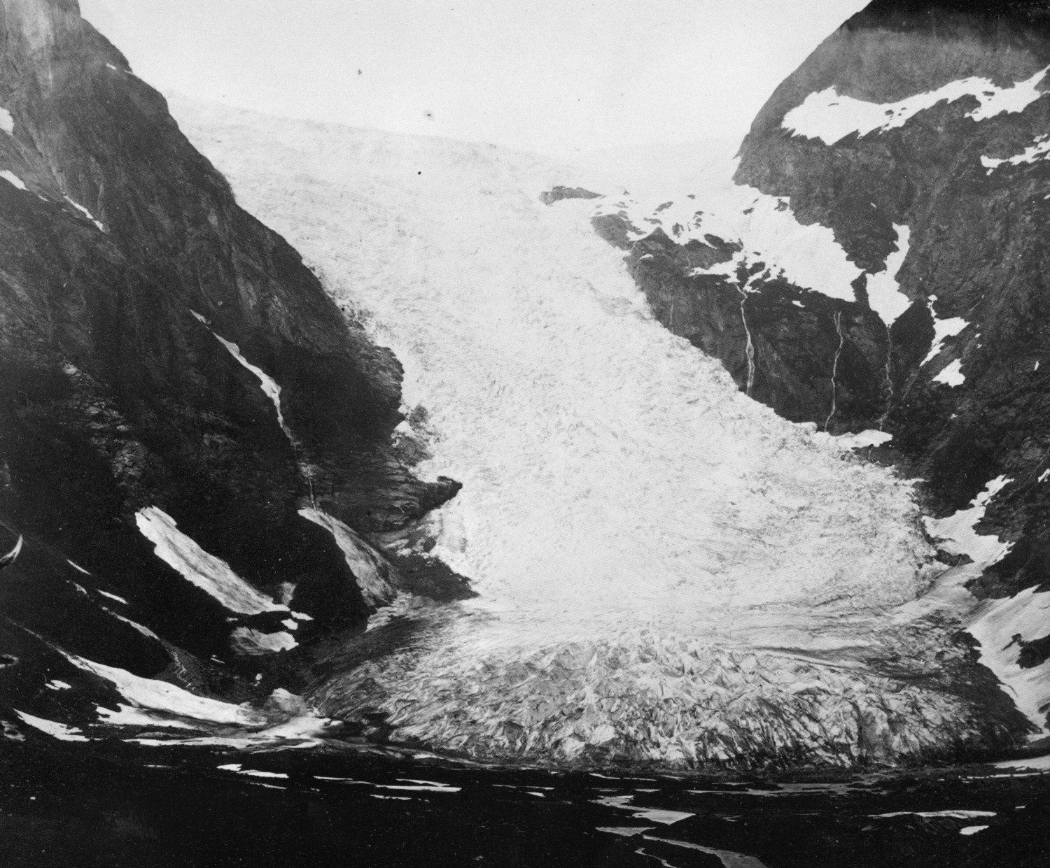
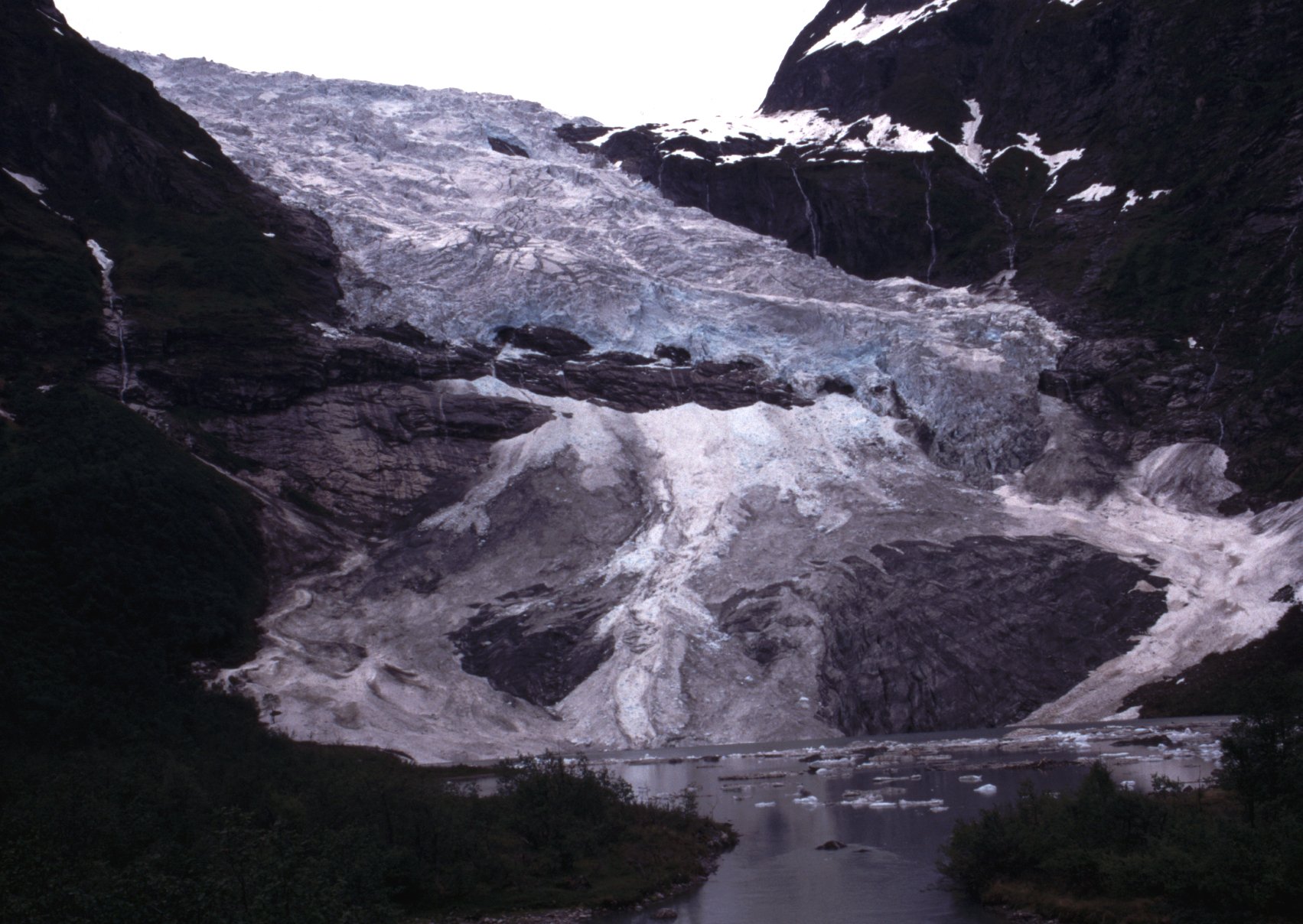
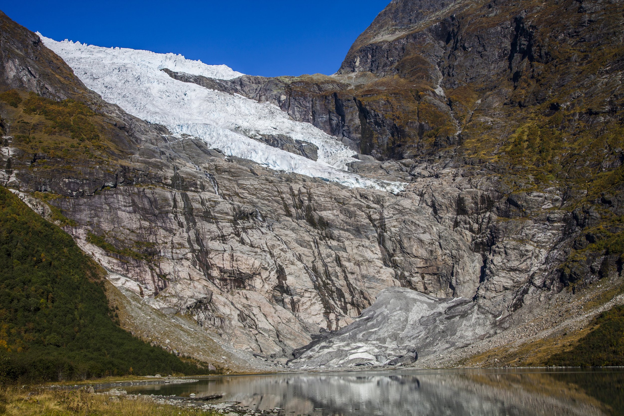
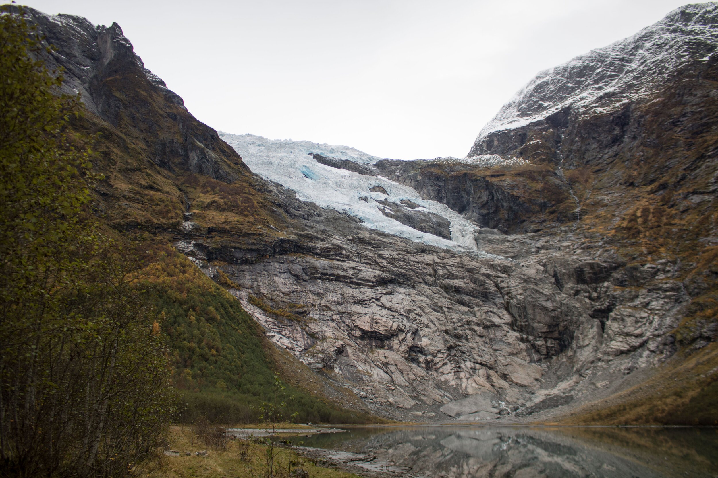
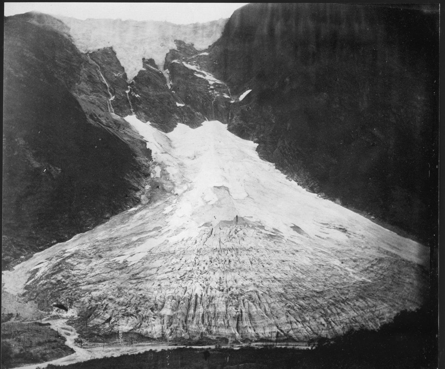
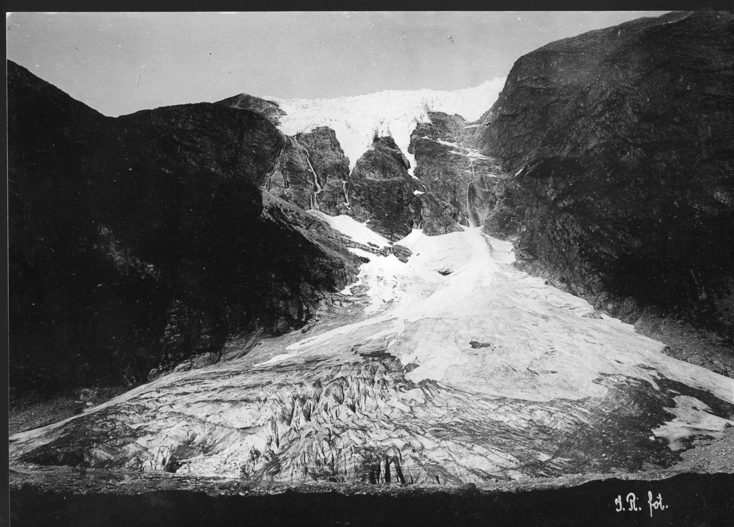
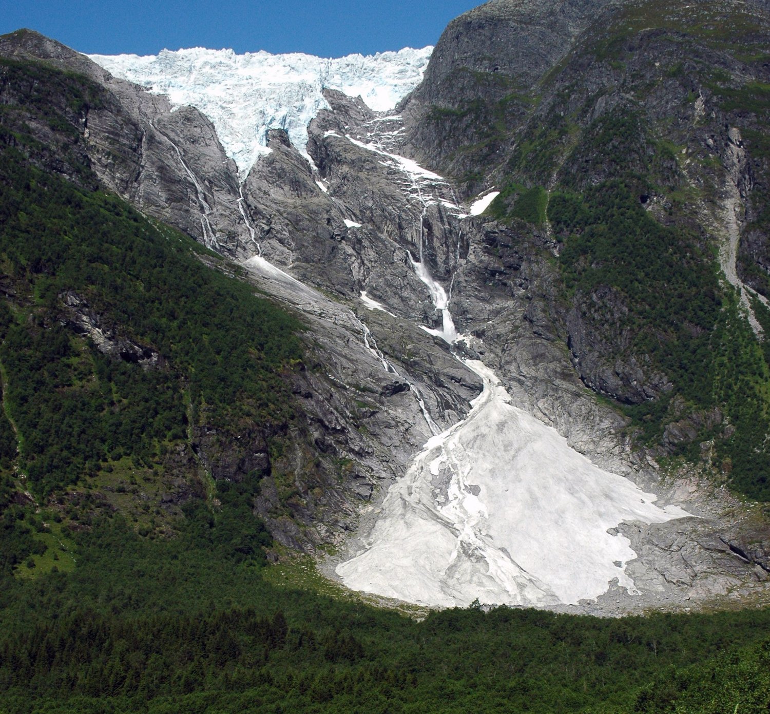
Bøyabreen is a short and steep glacier arm to the south of Jostedalsbreen that descends into Fjærland. Today there is a lower part that is not connected to the main glacier fall. The lower part is a so-called regenerated glacier which is dependent on receiving so much snow and ice from the main glacier that it does not melt away. But you don't have to go any further back in time than the 1990s for the two parts of the glacier to be connected. In the past, the glacier has of course been a coherent mass down in the valley, which we can see in the picture from 1868.
Bøyabreen is 5.7 km long and covers an area of 13.9 km2. The drainage basin starts at 1733 m above sea level and ends at around 504 m above sea level. A few hundred meters below this front starts the regenerated part of Bøyabreen. The front of the regenerated part of Bøyabreen lies at around 150 m above sea level, and it was on this part of the glacier that front position measurements were carried out in the period 2003 - 2014. These measurements were carried out by Norwegian Glacier Museum for NVE.
In 1972, a small plane crashed in the upper parts of Bøyabreen. The pilot died. The man was retrieved, but the plane itself remained on the snow-covered surface of the glacier. The plane was subsequently "pulled" by the glacier as it was covered by snow and later incorporated into the ice, and we waited a long time for the remains of the plane to appear in the front down by Bøyabrevatnet. In fact, we never thought we would see the plane again, until a German tourist sent a message to the museum's Instagram account at the end of September 2021. The message showed several pictures of pieces of aluminum, and it turned out that these were wreckage from the plane! One plane had turned into thousands of smaller pieces on its journey through the ice and to the front over 49 years. We have created our own exhibition about the plane in Bøyabreen, which we recommend seeing if you visit the museum.
Bøyabreen is located just off national road 5. It is possible to drive to the summer restaurant Brævasshytta, less than 1 km from the glacier front. Brævasshytta is built into a moraine ridge deposited by Bøyabreen in 1930. The glacier arm has been heavily visited by tourists since the end of the 19th century. The reason is that it is and has been easily accessible. Foreign tourists used to come to the fjords in Norway on cruise ships. Nowhere else in southern Norway is the distance from the fjord to the glaciers shorter than in Fjærland, and tourists could be transported up to the glaciers by horse-drawn carriage.
Supphellebreen
Supphellebreen is another glacier arm of Jostedalsbreen that descends into Fjærland. It consists of a relatively gentle upper part (called Flatbreen) down to around 1000 m above sea level before descending steeply towards Supphelledalen. At the bottom of the valley there is a regenerated part of the Supphellebreen glacier, which exists due to a large supply of snow and ice from the main glacier above. The Supphelle Glacier runs from 1734 meters above sea level down to 733 meters above sea level. The length is 8.4 km and the glacier has an area of 12.87 km2.
The regenerated part of the glacier starts several hundred meters below the main glacier. The glacier front reaches all the way down to about 60 meters above sea level, making it the lowest-lying glacier in southern Norway. It is on the regenerated part of Supphellebreen that glacier front measurements were taken in the period 1992 - 2014.
During the "Little Ice Age", the Supphelle Glacier reached its maximum extent around 1750 AD. Most likely, the regenerated part of Supphellebreen did not reach the main glacier at this time either. Nevertheless, the glacier front was almost 1 km further out in the valley than today. In the area in front of today's glacier , there are several clear moraine ridges that the Supphellebreen glacier deposited during periods when the glacier was either at rest or advanced less.
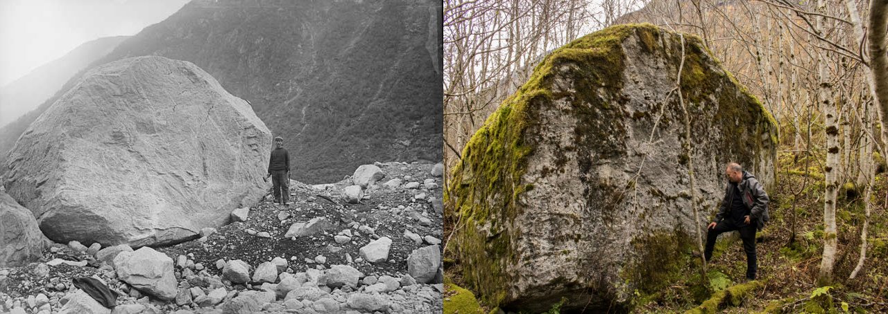
The fixed mark in front of Supphellebreen in 1899 (photo: NGU) and 2016 (photo: Pål Gran Kielland).
In 2017, we made a discovery of a large boulder that was used as a fixed mark when front position measurements started in 1899. It was the state geologist John Bernhard Rekstad (1852-1934) who created this mark to measure the distance to the glacier. At the time, he measured 77 meters to the edge of the glacier. Today, we find the boulder just over 400 meters from the glacier, which means an eighteen-mile melt of over 300 meters since 1899. In the 1899 photo, Rekstad himself is standing next to the boulder, while it is the operations manager at Norwegian Glacier Museum , Svein Arne Bøyum, who is pictured in the new photo.
Several glaciological measurements have been made on Supphellebreen. Mass balance has been measured in periods between 1964 and 1982, while front position measurements have been measured in three periods. The periods with front position measurements have not yet been able to be linked together, so it has been necessary to start at zero for each period. In recent years (from 1992 to 2014), Norwegian Glacier Museum has carried out the measurements for NVE.
In the same way as Bøyabreen, Supphellebreen has been a much-used glacier arm. This can largely be attributed to the fact that it is easily accessible by road all the way to the viewpoint below the falls.
Nigardsbreen
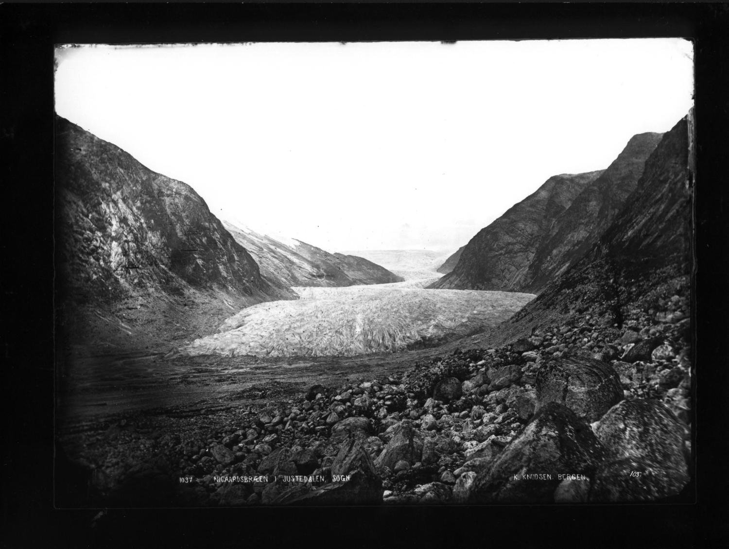
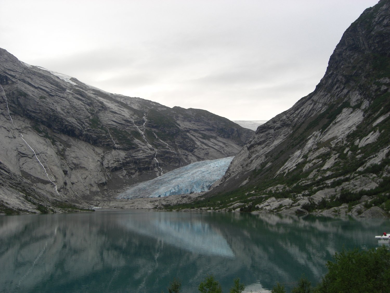
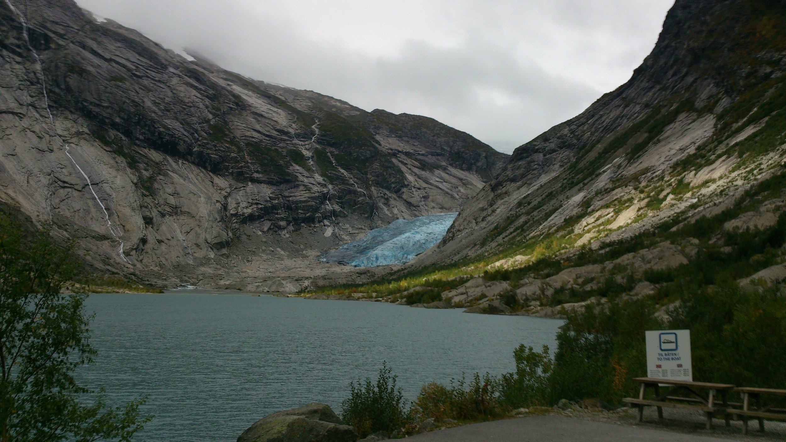
Nigardsbreen is one of Norway's best known and most studied glaciers. From the glacier plateau, it curves downwards through a narrow valley eastwards towards Jostedalen. The glacier is around 10 km long and extends from 1946 m above sea level to around 345 m above sea level. At 42 km2, it has the second largest drainage basin on the entire glacier, but only 6% of the glacier lies below 1200 m above sea level. The glacier faces southwest.
Due to its distinctive shape, easy accessibility and the offer of glacier tours, the glacier arm is a popular destination for tourists.
Illustration: Bjørn Vold.
Since 1899, the front position of the glacier has been measured and mass balance measurements have been made continuously since 1962. In addition, ice flow, meteorological data, and drainage and sediment transport have been measured.
The area in front of Nigardsbreen has been thoroughly investigated in several studies, both natural geographic and botanical. During the "little ice age" maximum in 1748, the glacier was about 4.5 km further down the valley than today (see illustration to the right).
After the glacier had reached its maximum position, it melted back with some pauses or minor advances that formed moraine ridges. These moraine ridges can provide important information about the size of the glacier and the time when the glacier reached a certain extent.
After the glacier retreats, the area will be open to plant immigrants. In such a landscape, there is a primary succession, where you can monitor how the species composition changes over time, in the same way as after the last ice age, for example.
In modern times, the glacier has been, and still is, extremely popular for glacier hiking among both tourists and people who know about glaciers. Many take the opportunity to walk up to the glacier front or join a guided glacier hike.
Since the glacier is always in motion, one must take into account that ice can fall out, which can be both harmful and, in the worst case, fatal.
Be careful and keep your distance from the glacier front, and follow advice and warnings about the dangers of the glacier.


